Across the bay from San Francisco, Point Richmond is a piece of the past that survived the industrial era and the birth of computer animation, quietly asking why gentle, human-scaled places are gone.
Limited geographically by the bay and a set of hills, highways, and train tracks, there’s a quaint little community of working-class origins hanging on the northern tip of the East Bay, on what were once native marshes, then pasture land for the Spanish ranchos, and then the western terminus of the Santa Fe Railway, as well as an early-twentieth century refinery owned by Pacific Oil, later to be Standard Oil.
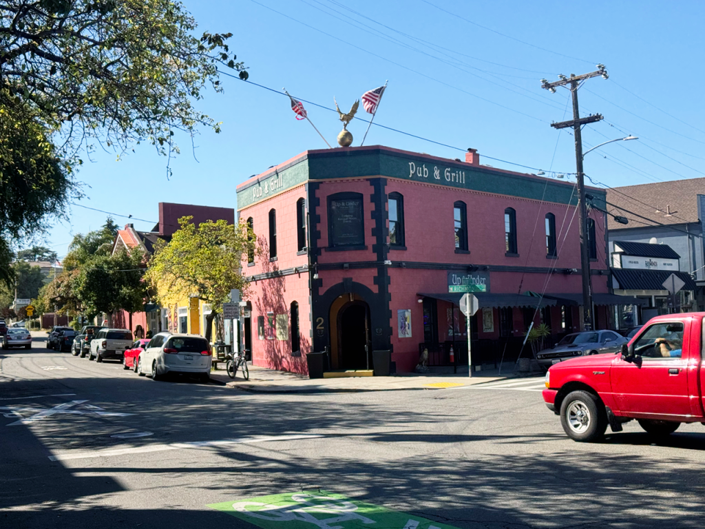
None of the people I’ve talked to since I’ve lived in the Bay Area have mentioned Point Richmond to me, which I find surprising, particularly because there’s so much to like about the little enclave frozen in time, so different from today’s cookie-cutter suburbs that resembles one of those idealized village scenes inside a West Coast edition of one of those Christmas water globes.
Or, described by San Francisco Chronicle columnist Margot Patterson Doss in 1968:
“[Point Richmond] sits on the Contra Costa (shore) like a little piece of yesterday that floated across the bay and stranded itself when the tide went out.”
Point Richmond isn’t an island, but its cul-de-sac character, tucked away on the Contra Costa bayshore and surrounded by communication arteries that isolate it from the rest of Richmond and the East Bay, has preserved it as amber sometimes does, with prehistoric insects trapped in time.
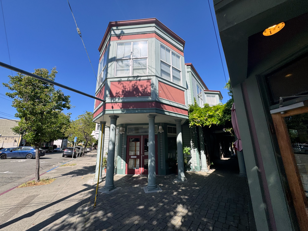
The Bay Area has changed much over the last century, but this residential and post-industrial inlet, often forgotten, retains its mixed-use character and architectural allure, as well as a triangle-shaped historic downtown where mom-and-pop businesses survive.
One of the Bay Area’s genuine deep-time portals
Many families from the East Bay take an always-busy stretch of arteries separating the hills and flats from the Alameda and Contra Costa shorelines, an area in which industrial waste gave way to marinas, sports facilities, park trails, and also many of the convenience landmarks of our era: a few miles down the shore from Point Richmond, near the old promontory of Point Isabel, many cars exit or cross highway 80 and highway 580 to get to Costco and its packed gas station, more busy than ever after the Iran-war price hikes.
This massive non-place, a beloved temple of convenience where many families spend a part of their dwindling leisure time, is the latest reincarnation of a distribution warehouse that opened on October 16, 1986; it originally started as Price Club (itself a reincarnation of Sol Price), a pioneering members-only discount warehouse that opened its first facility in San Diego. Originally serving small businesses, it merged with competitor Costco in 1993, and so, a few old-schoolers from the Richmond area have been crossing the divide to reach the backwater of Point Isabel for quite some time.
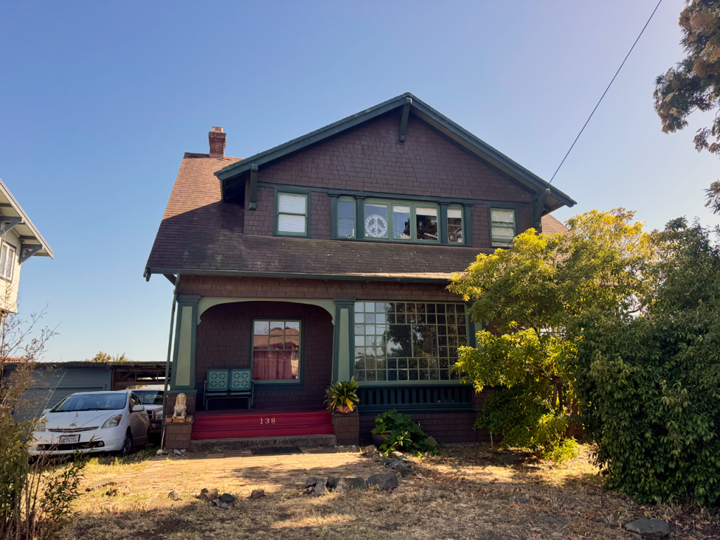
How many of them are aware of the existence of an old Bay Area community the way it was in the early 1900s at Point Richmond, without having to leave the same East Bay town, is a matter of speculation. So, this week I decided to travel in time and explore the main trends that have shaped the United States and the Bay Area since the early industrial era: from the irruption of commercial downtowns of lively streets of Queen Anne, San Francisco Stick, Neo-Classic, Eastern Shingle, Brown Shingle, Craftsman Bungalow, and California Bungalow-style houses, like the one surviving in Point Richmond, to the big distribution areas where many families buy the bulk of their groceries, like the Costco center, also on the Richmond shoreline.
Interestingly enough, my trip will always keep in the background the changing skyline of San Francisco, with the Golden Gate Bridge to the north and the Bay Bridge connecting it to the East Bay; I’ve seen glorious golden-hour sunsets while waiting on the traffic light to turn into Point Isabel, and also understood the name of “Contra Costa” county while standing in Point Richmond’s streets: “contra” costa means the other side of the then-occupied coast (the town of San Francisco and Mission Dolores), the same way “Alameda” County, to the south, is named the way Spaniards called the tree-lined pathways they designed for leisure outings.
Pasturelands across the bay from Mission Dolores
It turns out the first Spanish explorers in the area couldn’t take their eyes off a prominent creek across the bay from San Francisco, which was lined by a thick riverbank of willow and sycamore trees that reminded them of the famous shaded, tree-lined roads of New Spain and places like Cádiz, back in the distant metropolis.
Preserved Point Richmond is quite the contrast to the way San Francisco, or even Oakland, developed after the 1906 earthquake. Unlike the two nearby cities, which invested in designs and ornamentation in the same architectural styles, from craftsman-style houses to California bungalows to Victorian buildings, the buildings of Point Richmond are more frugal in ornamentation, lacking the colors and shapes of Italianate and Stick-Eastlake buildings in more affluent areas nearby.
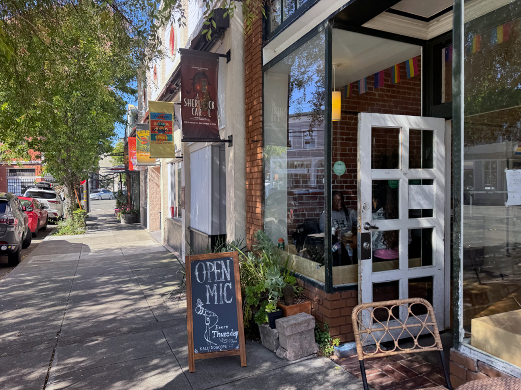
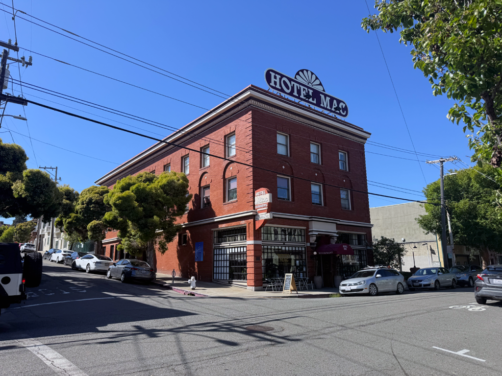
Perhaps this is one of the reasons Point Richmond looks so timeless and even elegant, evoking the styles of local contractors and self-builders from a century ago. According to the National Register of Historic Places, which recognized the value of Point Richmond in 1979, only a few buildings standing today in the old marsh and pastureland named Potrero, then dubbed Point Richmond, required professional architectural design, among them the brick-and-mortar Hotel Mac and the Richmond Fire Station No. 1 (both with sheet metal cornices that include dentils and egg-and-dart moldings), as well as the four churches built during the railway-and-refinery era:
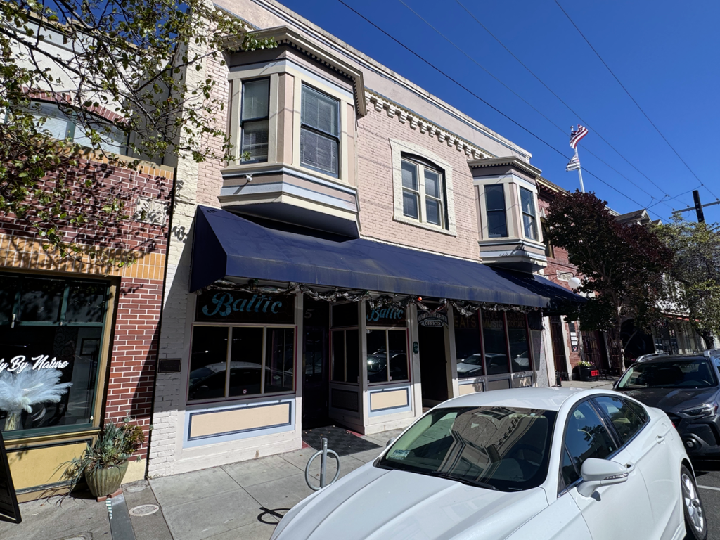
“Most dwellings and business buildings were likely constructed by small contractors or carpenters who had practiced their trade in the earlier building booms of Oakland and San Francisco with the help of mail-order plans or pattern books, and the ever-available selection of prefabricated structural and decorative building elements from the local mill. The commercial storefronts likewise indicate a carpenter adaptation of the styles of the day interpreted in either wood or brick, typically a two-story, flat-roofed building including parapets, upper bay windows, storefront windows and doors with clerestory and ‘light shelf’ above, and retractable awnings over the sidewalk.”
Donna Roselius, who founded the Point Richmond History Association in 1982 and then relocated to Oregon, explains how the place grew at boomtown speed, then stalled:
“Tents provided temporary housing for Santa Fe and Standard Oil workers while hastily constructed hotels and boarding houses popped up from semi-solid land. The first really permanent building was the Critchett Hotel, at the corner of West Richmond and Washington Avenues (now the site of the Point Richmond Market). When the Critchetts were settled, Mr. Critchett considerately provided a way to get his wife acquainted in her new community. He sent invitations to an afternoon tea to wives of the men he had met here, assuming that the women they had seen in the new town had accompanied his fellow pioneers. Only one guest arrived, the wife of Lyman Naugle, who was publisher and editor of the Point Richmond Record Herald. She was the only other “lady” who had arrived. Boarding houses, bars and bawdy houses were replacing the tents, most of which blew away in the first winter’s storms. Insufficient fill on the flatland made streets spongy all winter, and some of the first structures also blew off their shaky foundations. Women who came to join their husbands found it difficult to travel from their new abodes on foot, without high top boots and skirts pulled up beyond usually allowed limits.”
Evolving vernacular: from craftsman bungalows to non-places
Since we moved to the East Bay from a year in Midtown Palo Alto near Mitchell Park, and before that Europe, I had grown accustomed to seeing the mismatch of single-family housing styles of the Bay Area from the early twentieth century to our days. Point Richmond is a survivor of the 1920s’ styles and solid, high-quality construction as opposed to the styles and buildings that quickly went up with the postwar boom.
This switch towards more modular, lower-quality structures can be seen in Richmond itself. As the working-class town grew away from the water at Potrero-Point Richmond, tract homes and wood-frame houses finished with stucco took over the area; in Richmond, as in many other urban areas of California, many of the vacant lots included low-rise apartment buildings with carports underneath, which lacked any style and long-term aspiration. Low quality and lack of design became so pervasive that today Point Richmond, a working-class community developed in an earlier era, is a little mixed-use village that blends coherence of style with the high walkability rates that new urbanists dreamed of from the Jane Jacobs era onwards.
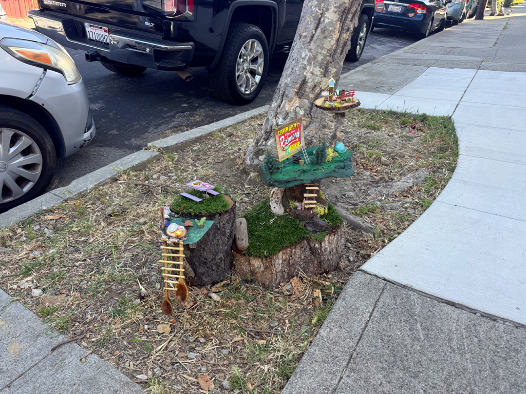
But, as any San Franciscan interested in urbanism could assess half an hour from home, the dream of the New Urbanism pundits already existed; it only got cornered by convenience, car reliance, and housing prices, prompting people further away from areas where housing availability didn’t keep up with economic dynamism, and the Bay Area is the poster child of such an affordability and commuter-trap phenomenon.
Take a trip with me to the forgotten, unassuming enclave of Point Richmond, first stopping at today’s temple of convenience, also in Richmond by the water, Costco Wholesale. From most of Berkeley, you drive down to the bay flats and get on I-80 heading north (signs read Sacramento/Vallejo), basically tracking the shoreline northwest as the San Francisco and Golden Gate skylines shimmer out west to your left, making you appreciate the natural beauty of this bay, perhaps only rivaled, in my experience, with the breathtaking Sydney Harbor.
Then the freeway forks: I-580 West peels off to the left towards the Richmond-San Rafael Bridge, but we want to take I-80 and continue to the north, taking the first exit available almost immediately. We look at San Francisco and the Golden Gate once again as we sit in the light, turn left over the bridge, and head into the Southwest Annex, where the Costco mole sits. It’s an ugly non-place like countless others, surrounded by equally impersonal freeway-adjacent warehouses. But hey, cheap stuff if you buy in bulk, which is one of today’s universal sports.
Driving through the tunnel into Point Richmond
After a visit to the pump to get some gas on our 2017 Subaru Outback 3.6R (the extra kick of the bigger engine and 6-cylinder engine instead of the current 4-cylinder for the whole model range, facelifted as yet another SUV), I leave the marina flats of Point Isabel to get back on I-580 West toward the bridge. With no traffic (which you may encounter unless you time your trip on the few windows in which nobody is trying to get around this clogged artery), it will take you ten minutes to get to the place where you can cross over the Richmond inner harbor channel. Take the Canal Boulevard – Garrard Boulevard exit, and you’ll soon have the feeling you’re going to an island instead of a little peninsula, for you have to cross the Garrard Tunnel to get there, driving under Nicholl Knob, a 371-foot peak fencing the area from the rest of the East Bay and preventing any further development.
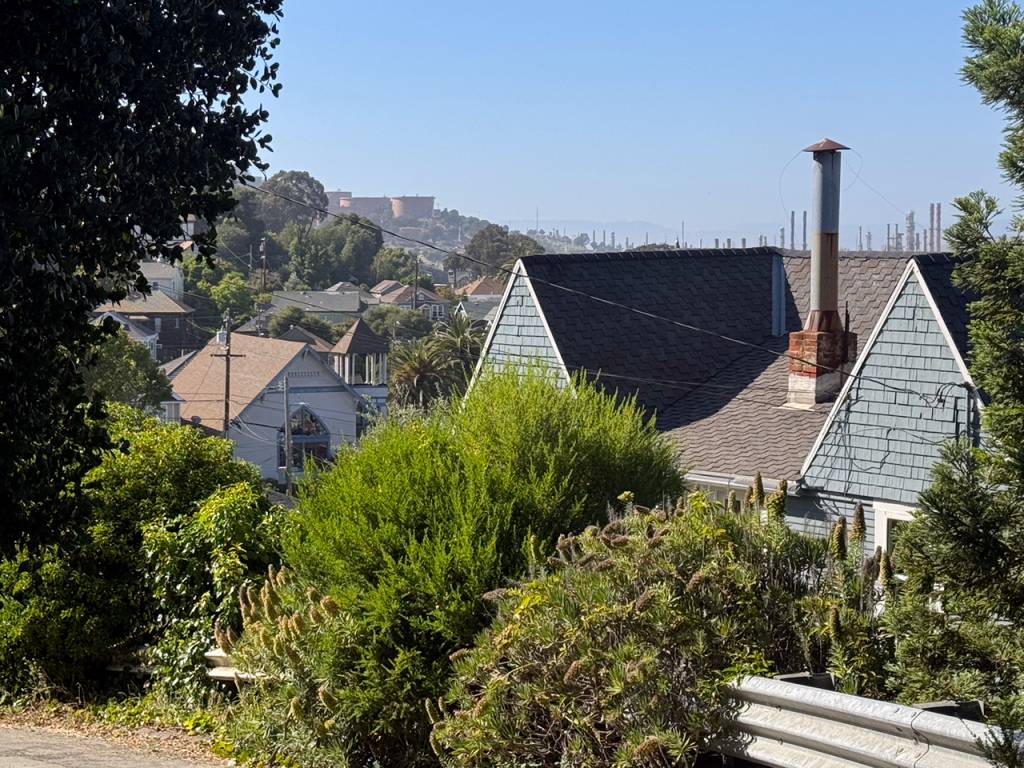
Getting in and out the Garrard Tunnel makes one feel that time travel is possible, especially as, on the other side of the tunnel-view threshold, one is expelled directly into the old village, with the menacing presence of the Chevron refinery on the ridge above it, a reminder of the working class roots of a place that at times could feel a bit like a chunk of the now-upscale Sausalito or Tiburon (Kirsten’s California side of the family settled in Sausalito before World War II).
It’s time to find parking, for Point Richmond invites this Southern European transplant of Iberian roots (just like Francisco Castro, the first rancher settling in Potrero as the owner of the Rancho San Pablo, granted in 1823, a mere two years after New Spain seceded from Spain) to do the tour on foot. I have no mule or horse, and the pasture times of the Potrero era are long, long gone, only a few names of roads, streets, and accidents remaining.
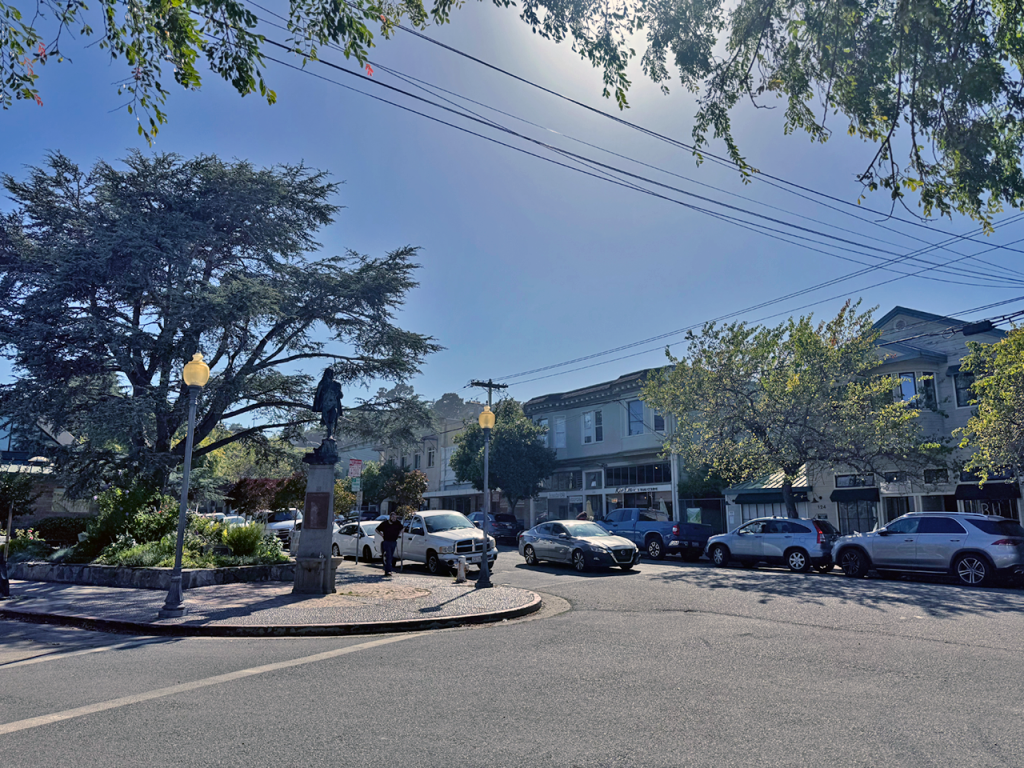
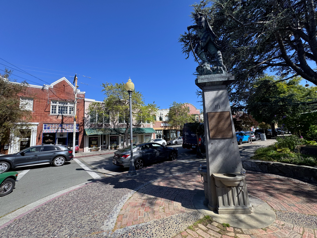
I left my car around the triangle where Washington Avenue, Park Place, and Richmond Avenue converge. From there, one takes a look and believes again in gentle urbanism, far from impersonal sprawl but not too crowded, interested in perspective and craftsmanship, the utilitarian beauty of yesteryear that ages well in the Bay Area, once the fog’s influence settles as patina over the decades. If Washington Avenue feels like a real downtown straight from the past, it’s because it actually is: Point Richmond was Richmond’s actual downtown from the late 19th century until the 1920s, when the town expanded inland.
First, I take Washington Avenue (whose name reminds me again of Australia, where everything seems to be named after Sydney or Macquarie), and stumble upon low brick-and-stucco storefronts, as well as a couple of bars, antique shops, and the Hotel Mac, a 1911 red brick building that could appear in some story about the Bay Area beatniks depicted by Jack Kerouac in The Subterraneans.
A long time ago, workers’ songs inside the Baltic
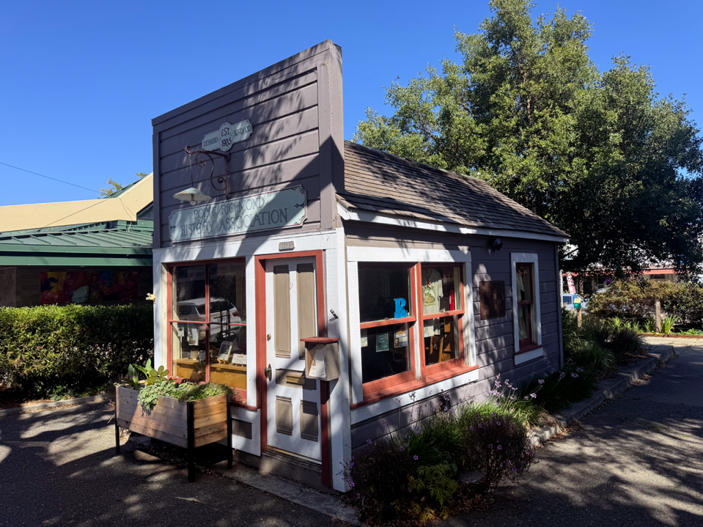
There’s a wee, almost frontier-style building that hosts the little Point Richmond History Association Museum, which I find closed. It’s tiny and volunteer-run, and it reminded me of the hippie ethos still present in backwater places like Bolinas.
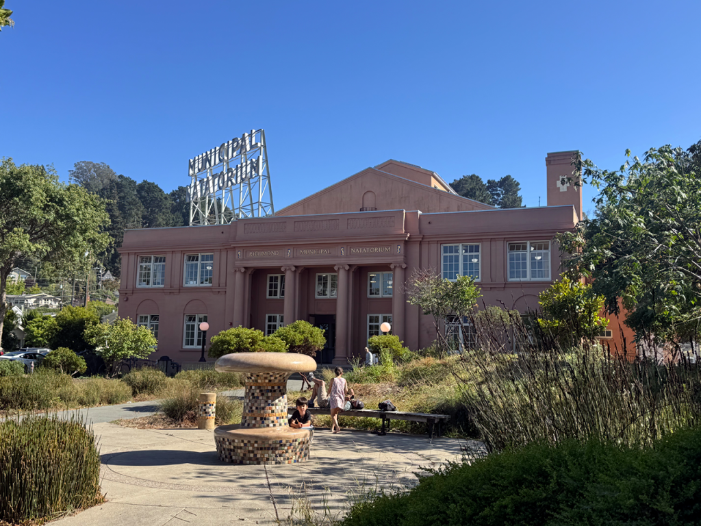
I decide then to walk up the gentle slope to reach the foot of the knob, where another surprise awaits. What I see brings back an article I read about the derelict, out-of-proportion Sutro Baths, a mammoth saltwater swimming pool complex built on the West Side of San Francisco by Adolph Sutro as a turn-of-the-century engineering and technical marvel with a classical exterior that decayed over the decades and burned down in 1966.
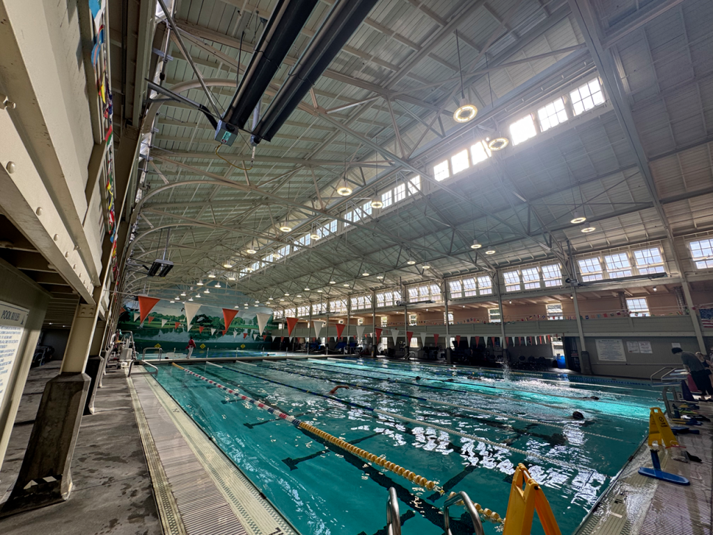
Adolph Sutro’s engineering marvel didn’t prevail nor ever live up to its public-service promise (for one, it’s always chilly in that part of San Francisco), but it turns out Point Richmond has its own classic-looking Municipal Natatorium, locally known as The Plunge: a beautifully restored 1920s indoor pool that’s not only the enclave’s architectural jewel: one can actually swim in it, imagining how, three generations ago, neighbors would be doing the same, only in bathing suits of the Roaring Twenties.
I read somewhere that the Baltic, a tavern where I’m headed now, survives from the early years, when Santa Fe Railroad and Standard Oil operations built the neighborhood. At that time, Point Richmond must have been rugged and influenced by the old school camaraderie that shaped Jack London’s early working-class ideology; to the point, I learn, that London himself was one of the habituals at the Baltic.
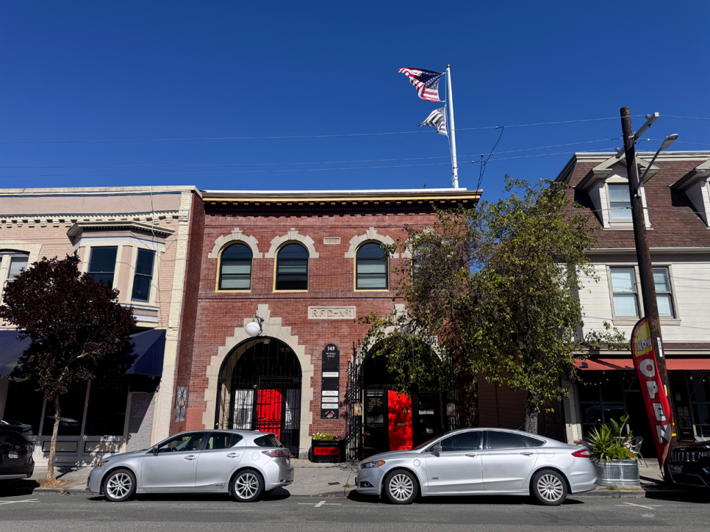
I rejoice with the mere feeling of evoking London in the area, as I face the reality of the Bay Area: like many other picturesque places in a region that has grown more affluent and is about to create, once again, the fantastic riches of a new class of tech titans thanks to AI, Point Richmond is now an affluent, rather upscale district, perhaps the aspirational place for people from Richmond in search of a still-rugged-yet-polished charm, much in the way of Sausalito and other places with a working class past.
Too difficult to replicate on the cheap?
With its unassuming pre-war, movie-set aesthetic, Point Richmond tells us that there’s no such thing as a walkable, charming neighborhood in the Bay Area that can stay affordable to everyone. So, as if it were a Pacific reference to the archetypal messages from F. Scott Fitzgerald’s Valley of Ashes between the city and the mansions of Long Island, today’s Point Richmond, while affluent, still abuts the menacing Chevron refinery, still the inescapable symbol of the broader city’s industrial identity.
Today, however, if you visit Point Richmond, you’ll get more of a Sausalito or Carmel-by-the-Sea vibe (minus the snobbery) than refinery-neighborhood roughness. Not surprisingly, the enclave’s working population is overwhelmingly employed in executive, management, and professional occupations. Perhaps, one thinks, the white-collar population that replaced its early working-class inhabitants.
Earlier, I mentioned one of the area’s beloved activities, a Costco visit, mandated by convenience and grocery prices; there’s another, very contemporary activity when it comes to the Bay Area, or anywhere else in the United States at this point: as we imagine a place described by someone, we go on and try “Zillow surfing” the premises. Doing so in the tiny, tucked-away, protected, and unable-to-grow Point Richmond makes one realize that this is a place where people don’t sell often. The only listings seem to refer to small buildable lots, which — not surprisingly — are far from affordable.
With relatively small single-family homes, often with two bedrooms and one bathroom, Point Richmond’s median price is unequivocally over one million, which can appear to be a lot anywhere else in the world, but yet again this is the Bay Area, and nearby Albany, Berkeley, or even El Cerrito and the Oakland Hills are also out of reach for many.
Lunch at the Hidden City Cafe
If you think the tale of Point Richmond is not a part of the living tale of the Bay Area or America, for that matter, consider the birth of computer-animated films: in 1990, an obscure animation studio that wanted to involve computers in storytelling, Pixar, moved from San Rafael in Marin to the Point Richmond Tech Center, staying there for ten crucial years and creating the entire arc of Toy Story, from the 1991 Disney deal through the November 1995 release.
At the time the company moved to the quaint Contra Costa enclave, Pixar was a struggling hardware-and-software company, personally bankrolled by Steve Jobs at a loss. In early 1991, a layoff of 30 people cut the company to 42 employees; right around then, with Jobs’s support, the company secured a $26 million, life-saving deal with Disney to produce three computer-animated features.
That’s how the first fully computer-animated feature film in history ended up being conceived in an industrial park between a railroad point and an oil refinery.
It was the same ground the Spanish had called the Potrero, a point joined to the mainland by tidal marsh long before any refinery or rail yard existed. The settlement that grew up around the Santa Fe terminal and its tracks, amid the abandoned farmlands, was first known as East Yards, and only afterward took the name Point Richmond.
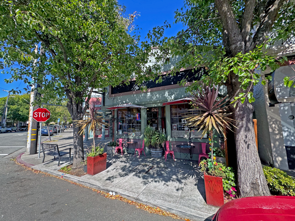
One of the local gems is a lunch that happened on Washington Avenue. In the early summer of 1994, with Toy Story nearly finished, John Lasseter, Pete Docter, and Joe Ranft sat down for lunch at the Hidden City Cafe, not far from Pixar’s head office. That lunch was used to sketch out the films that would carry the studio for the next decade, beginning with A Bug’s Life.
Back to the future
The lunch is somehow connected to Jobs, who had designed Pixar’s headquarters as an open structure with an atrium everyone had to pass through: Jobs believed the key to creativity was serendipity, and so he maximized interaction amongst different roles by design. In a way, the Hidden City lunch represented that philosophy spilling out of the building and into the village.
That lunch had been preceded a few years earlier by another, between Jobs and Lasseter, in which they talked about Pixar’s destiny. Lasseter made the case for filmmakers having a final say on creative decisions. Jobs agreed; Jobs understood that Pixar needed him as an investor and strategist, but the company was better off if he didn’t participate in the filmmaking.
On the way out, one crosses back through the Garrard Tunnel. The threshold towards the Bay Area dimension works in reverse, propelling you back into the hyper-competitive present that gave birth to all the technical tools we use today. The present rushes back, the freeway, the warehouses, the packed pumps promising “cheaper” gas at barely under $6/gallon.
That’s why it feels as though the town one just walked, built by carpenters with pattern books and mail-order plans, was merely a mirage of a more innocent time, a slight glitch in the matrix. Perhaps places like Point Richmond are more than that: their walkable, fine-grained, human-scaled streets, the kind you wander like an old-school flâneur, are testimony to the simplicity of it all. It’s not rocket science, just human-scale, simple, enchanting design.
As new waves of opportunity come and go in the Bay Area, the most dense innovation hub in the world, many wonder how come gentle environments like Point Richmond became the exception and not the norm. It’s hard to imagine the place as flats of pasture and marshes, disconnected from the rest of the East Bay during high tides. The industrial past is still present, with the Chevron towers watching from the ridge like the eyes of Doctor T.J. Eckleburg over Gatsby’s valley of ashes.
Down in the village, someone will be doing laps in a pool from the 1920s, thinking about the boom-and-bust cycle much like the neighbors who saw the San Francisco skyline from a distance a century ago, right before the Golden Gate went up.